Search The Map
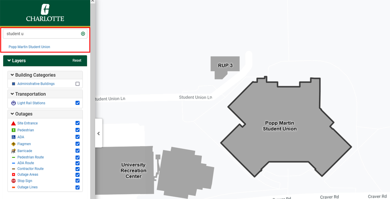
Searching for a building on campus is easy! Just type what you’re looking for in the box titled “Search the Campus”. You can search by:
- building or parking lot name
- building abbreviations
- building numbers
- specific dining or service location (Starbucks, Auxiliary Services, etc...)
- specific layer or layer category (Dining, Coffee, etc...)
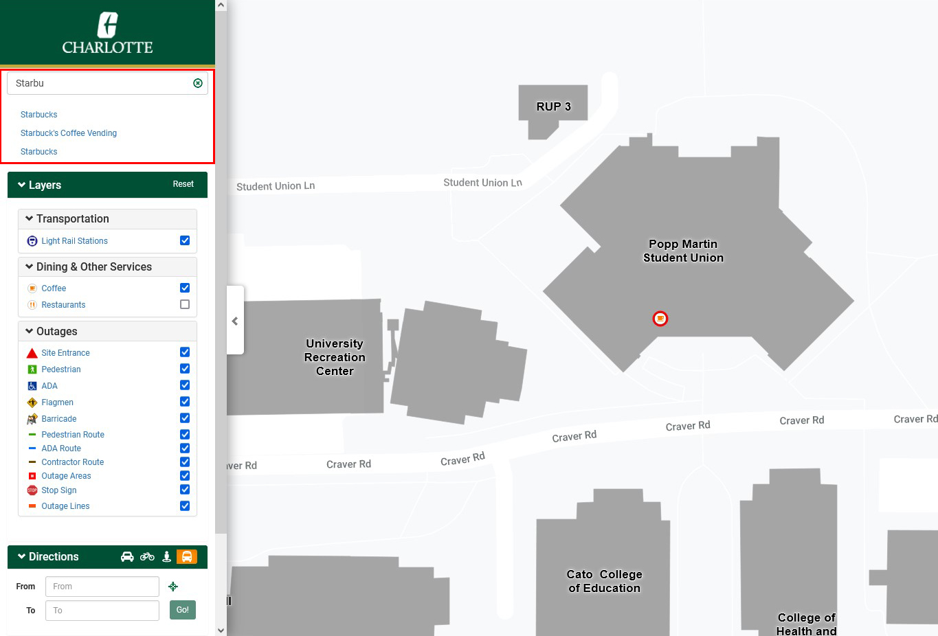
Searching for a location filters the layers to only display layers where the search text is found. Clicking the "X" in the search box show all layers.
Map Layers
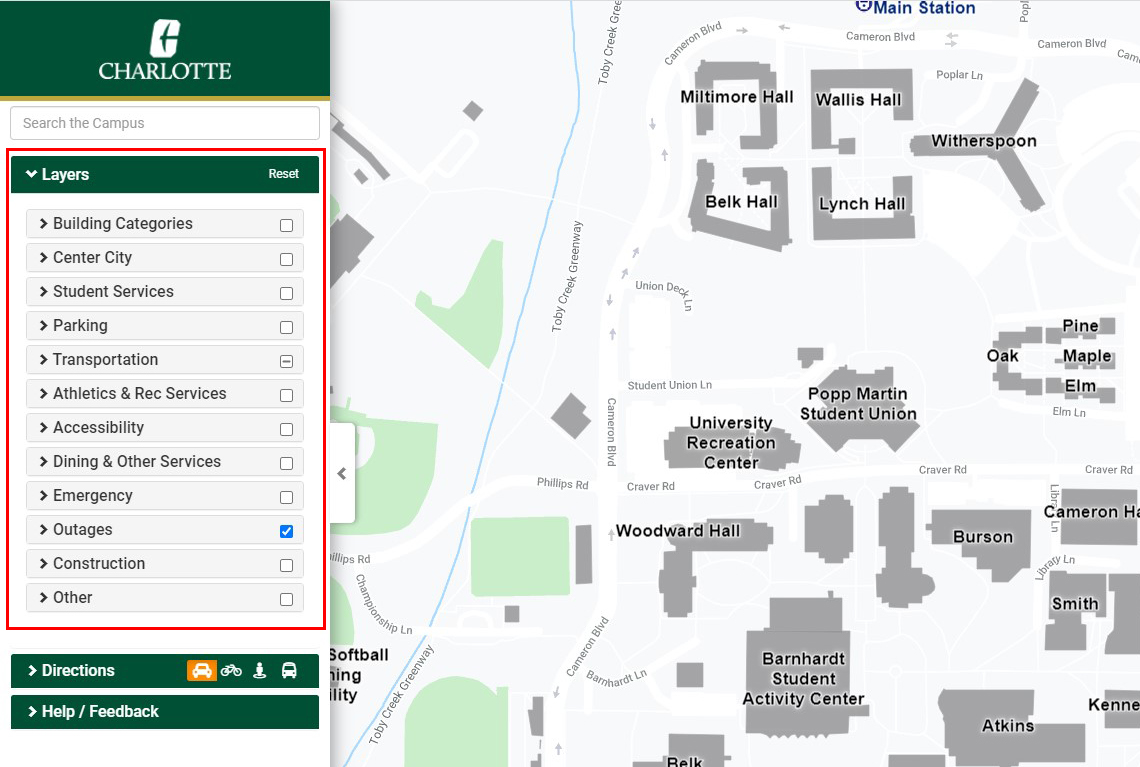
Clicking on the “Layers” menu, expands a list of all the layers that you can look at. Check the checkbox beside the layer (or layer group) that you would like to see and this information will be loaded on the map. You can click on buildings and points (such as dining options) to get more information in a pop-up information window. Selecting the “City Bus & Shuttles” layer will include live data of the campus shuttle locations. It also shows the arrival times of shuttles.
Directions
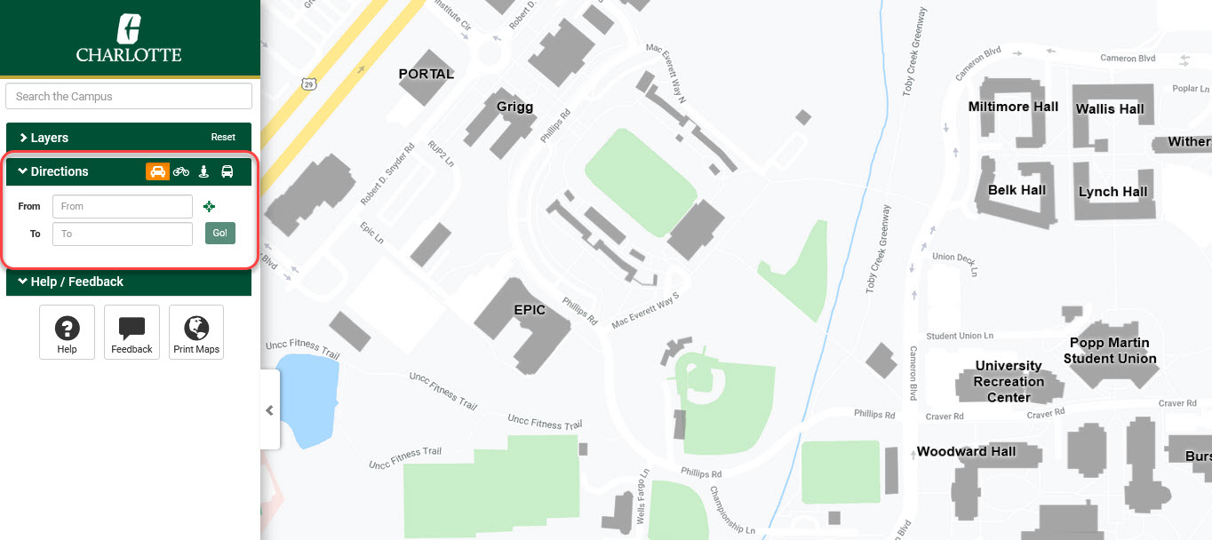
Expanding the Direction panel, you can type in the “To” and “From” boxes to get driving directions to your destination. You can also print these driving directions.
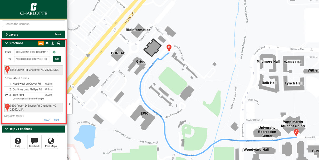
The example above shows directions from the Student Union to Duke Centennial Hall.
Printable Maps
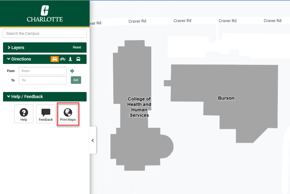
Clicking on “Printable Maps” will navigate you to Facilities’ page with printable maps, including an Illustrator file.
Current Location
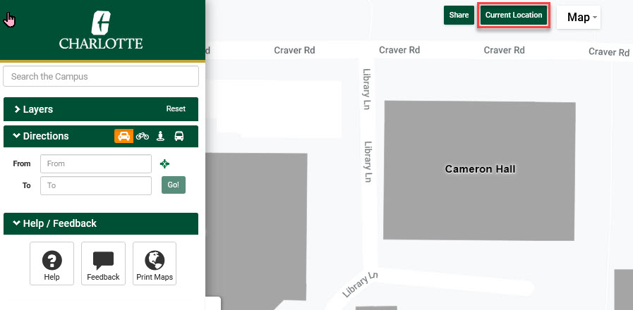
Clicking “Current Location” will center your current location on the map. Note: This is more accurate on a mobile device. There may be some slight inaccuracies on desktops and laptops.
Share Current View
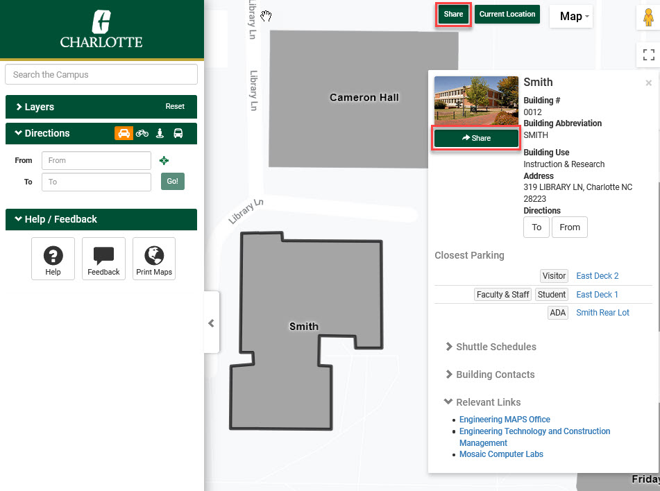
Click “Share Current View”, and you can share everything as you currently see it on the map. Any layers you have visible will be shared, in addition to any information window that might be visible.
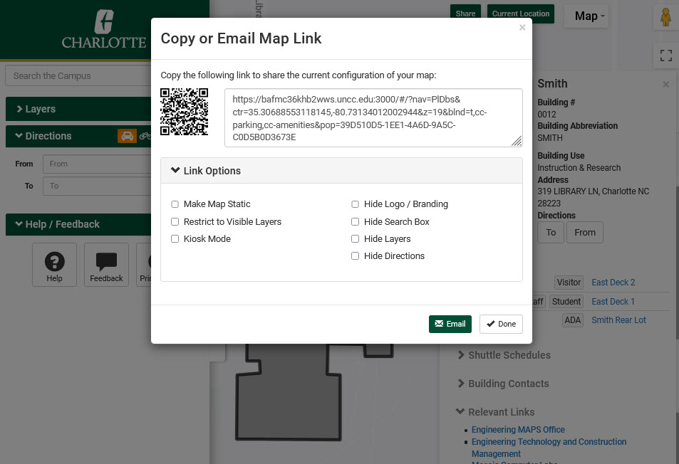
There are many link options. You can make the map static (not allow the user to drag around the map). You can restrict to Visible layers (show only those layers in the navigation pane that you have selected). Also, you can hide the logo / branding, hide the search box, directions panel, or the layers panel. You can generate a QR code that you can print or email, just like you can for the generated link. Clicking "Email" will open up your email program with a new email created.